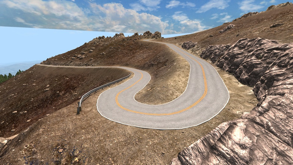
PIKES PEAK - LIDAR EDITION 0.94

![Lamborghini Urus [PACK]](https://temp2.modland.net/i/6a4a2a9c6e389/0_modland.webp)
![Rivian R1T/R1S [PACK]](https://temp2.modland.net/i/6a4a2a9c6e389/6a5cd84b36470/0_modland.webp)
5/5,
2
votes
12.4 miles and 4,300 feet.
The surrounding area is a version of the real landscape
Every detail has been added, including: protective rails, large rocks and logs along the road, placement and scaling of trees, road signs and markers, and even drainage gutters.
From a technical point of view, this huge 8192 pixel map is the officially supported size, which requires a system with more than 8 GB of memory, and the download process takes several minutes.
Version 0.94:
- Fixed missing materials;
- Fixed non-functioning roads/paths;
- Now everything works correctly.
CREDITS: Ewanc
External Download Links:
- Sharemods.com - pikespeak.zip [321.9 MB]
You Might Also Like »

![Lamborghini Urus [PACK]](https://temp2.modland.net/i/6a4a2a9c6e389/0_modland.jpg)

![Rivian R1T/R1S [PACK]](https://temp2.modland.net/i/6a4a2a9c6e389/6a5cd84b36470/0_modland.jpg)


4 Comments
upgrade needed (Guest)
have the tree stoped being made of no material ?
Loading...
upgrade aquired (Guest)
my my it indead stoped being made of no material
Loading...
skatr (Guest)
The King Of Reupload: kyhk
the gift for kyhk is a poo-mobile :)
Loading...
atayarabani
login bro
Loading...