


![BMW M3 G80/M4 G82 [Pack]](https://i2.modland.net/i/6721e9c21f713/photo_2_2024-11-13_13-15-59_modland.jpg)

5/5,
4
votes
Irohazaka Map
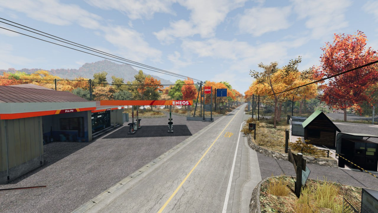
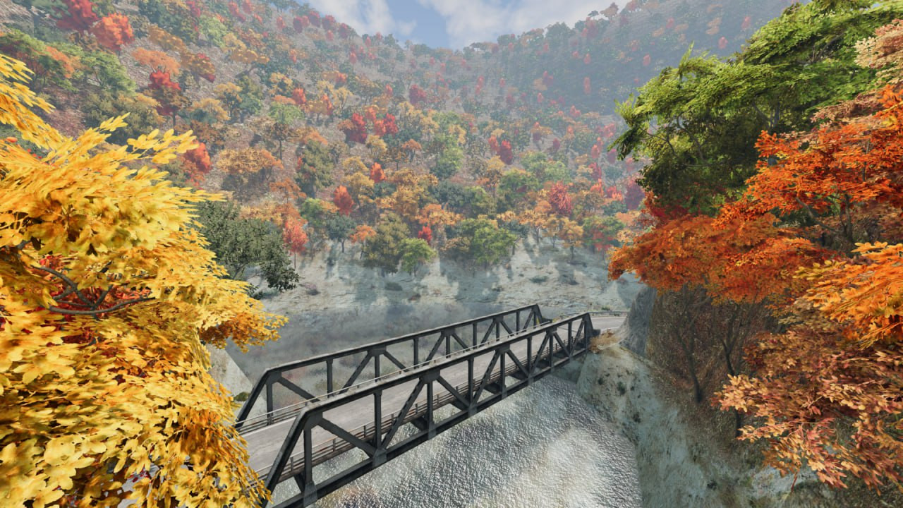
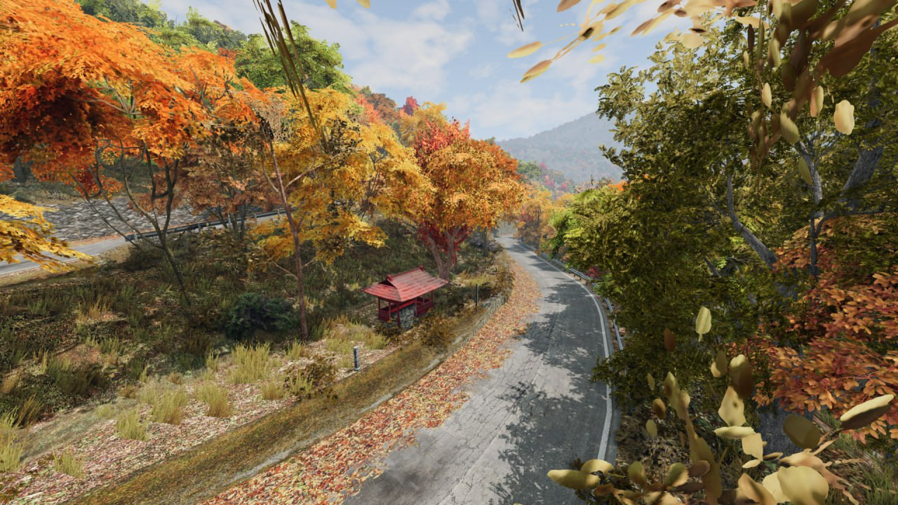
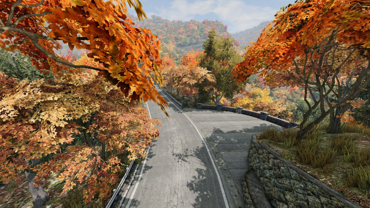
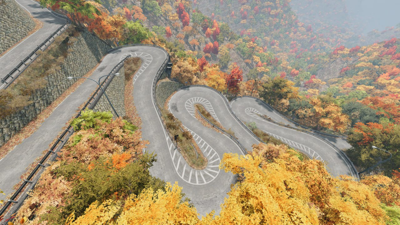
Experience the iconic twin one-way mountain roads of Irohazaka, located in Nikkō, Japan. Famous for their extreme hairpin turns, steep elevation changes, and beautiful forest scenery, these roads are a paradise for drifting, touge battles, and challenging hill climbs.The pass features two separate roads: one for uphill and one for downhill traffic, both twisting through dense mountainside forests with a total of 48 hairpin curves — one for each character of the old Japanese alphabet (Iroha).The narrow roads, sharp corners, sudden elevation shifts, and authentic guardrails make it a true test of skill. Perfect for time attack runs, drift sessions, or just enjoying a peaceful drive surrounded by nature.
Dimensions:
Total Driveable Distance: ~8 kilometers (5 miles) (combined uphill and downhill routes)
Road Width: ~5.5 meters (18 feet) (standard narrow mountain road)
Elevation Change: ~400 meters (1,300 feet) from bottom to top
Hairpins: 20+ on the uphill road, 28+ on the downhill road
Map Size: ~4 km x 4 km (terrain area)
Features:
Realistic elevation and road curvature based on real GPS data
Authentic Japanese vegetation and road-side details
Guardrails, signs, and road markings true to the original pass
Hidden parking lots, photo spots, and scenic overlooks
Day and night cycle supported
Optimized for smooth gameplay on mid to high-end PCs
External Download Links:
- Modsfire.com - Irohazaka.zip [Download Link] [143.84 MB]
Direct Download Links
latest
initial
Version
1.1
· BeamNG.drive
0.35.x
1 year ago
Game Versions:
0.35.x
Irohazaka_modland.zip
[Download Link]
direct download
· 143.84 MB
· added 1 year ago
This File is Scanned by Antivirus and is Safe.
More Details
About Mod
| Latest Version | 1.1 |
| Game | BeamNG.drive |
| Category | Maps |
| Game Version | 0.35.x |
| Downloads | 3858 |
| Created | 1 year ago |
| Last Virus Scan |
0/97
More Details |


![Lamborghini Urus [PACK]](https://temp2.modland.net/i/6a4a2a9c6e389/0_modland.webp)
![Rivian R1T/R1S [PACK]](https://temp2.modland.net/i/6a4a2a9c6e389/6a5cd84b36470/0_modland.webp)


1 of the most pick mods
japanese maps are the best, wish there was a map about bucharest map and so much more romanian locations in beamng