Paris suburbs map 1:1 v0.1.6b

Latest Update
latest
Version
v0.1.6b
· ETS 2
1.58.x
3 months ago
Changelog v0.1.6b
Crash fixes related to version 1.58
Bug fixes
Changelog v0.1.5b
– Fix for crashes related to 1.56 (when creating a profile & loading the game)
– Various bug fixes
Changelog v0.1.5a
Addition of Paris’ 16th arrondissement:
Monuments: Eiffel Tower, Palais de Chaillot & Place du Trocadéro
Added a repair workshop
4 new companies
Addition of Paris’ 13th arrondissement (1 new company)
Other: 9 km of new roads and 24 new deliverable companies spread across the map
Added functional pedestrian crossings
New bus stops with stop names displayed
Added AI bicycles and scooters in certain areas
Added new license plates (old french plates, diplomatic plates, etc.)
Fixed broken traffic lights in Paris
Added and modified random events
Added 5 types of fines
Added 200+ AI vehicle skins/variants
Added 20+ skins for modded vehicles (Iveco Evadys & Skoda Superb)
Other small changes
Fixed various bugs
Changelog v0.1.4a
Bagnolet Rework:
Rebuilt Porte de Bagnolet interchange
Rebuilt Bel Est Shopping Center
Added a purchasable garage
2 new companies
Addition of a section of the Bois de Vincennes:
2 new companies
Addition of Rosny-sous-Bois City Center:
Added a purchasable garage
9 new companies
A3 Motorway Rework
Added several purchasable garages
Added skins for modded vehicles (skoda superb) (by Rayen and JenNezMare)
New license plates (by Adyox)
New road signs (by Adyox)
Other changes
Reduced mod file size
Bug fixes
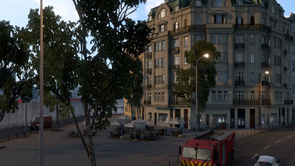
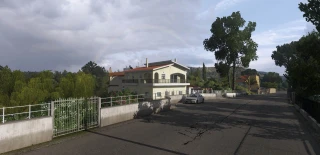
This is my first map and project inspired by the Île-de-France region, located in France wich includes the city of Paris and it’s suburbs. The map is standalone and it’s size is approximately 1:1 but some parts may not look like the real thing and have been subject to changes.
LAST UPDATE : V0.0.5
[+] Addition of the city of Créteil, specifically the Échat district.
[+] Addition of Villemomble city center.
[+] Extension of the A4 to the town of Collégien.
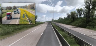
[+] Addition of country roads.
[+] Added custom AI vehicles and decoration.
[+] Custom Parisian traffic lights.
[+] Added details in Paris.
[+] Addition of the English translation of certain GPS messages for other languages (department change message…).
[+] Fixed some bugs.
[+] More than 22 km of roads added.
[+] And much more !
KNOWN BUGS
-> Somes errors can be found in the console. (due to some imperfections in mapping and custom objects)
-> Some areas cannot be discovered. (which leads to the impossibility of having 100% of the map discovered)
-> highway signs may be unreadable at night in some areas.
-> Some speeds limits doesn’t work.
Credits:
Map by Georges93
Custom traffic by Rayen
LAST UPDATE : V0.0.5
[+] Addition of the city of Créteil, specifically the Échat district.
[+] Addition of Villemomble city center.
[+] Extension of the A4 to the town of Collégien.
[+] Addition of country roads.
[+] Added custom AI vehicles and decoration.
[+] Custom Parisian traffic lights.
[+] Added details in Paris.
[+] Addition of the English translation of certain GPS messages for other languages (department change message…).
[+] Fixed some bugs.
[+] More than 22 km of roads added.
[+] And much more !
KNOWN BUGS
-> Somes errors can be found in the console. (due to some imperfections in mapping and custom objects)
-> Some areas cannot be discovered. (which leads to the impossibility of having 100% of the map discovered)
-> highway signs may be unreadable at night in some areas.
-> Some speeds limits doesn’t work.
Credits:
Map by Georges93
Custom traffic by Rayen
When I try to load the this mod, it says Incompatible in red, and I can't use it (I have latest game version)
@Vic So you don't have the required DLC
Hi mods82 ! It crashes for me because it only shows the map but no cities! Please fix it !
@John S. This is standalone map! For this map to work, you must create a new profile, connect only this map and select the idf.mbd module. And only when the map loads and works, you can connect other mods one by one.
je n'arrive pas a sélectionner une destination de voyage rapide peut t'on m'aider ?
is this compatible with the paris rebuild mod?
Video ; https://youtu.be/t30Rde3SkOk